History · CVRA

Our village, our history

Explore the places, people and memories that shaped Charlton Village—from ancient traces and Cerdentone in 1086 to the community we share today. Explore the timeline to jump to a chapter in Charlton Village’s story, or scroll down to enjoy the history in order.

Charlton Village sits within a landscape shaped by farming, the River Ash, water engineering and changing roads. Its story reaches beyond today’s boundaries, connecting us with Littleton, Sunbury and the wider Thames valley.

Follow the original records and help us keep our shared history alive.

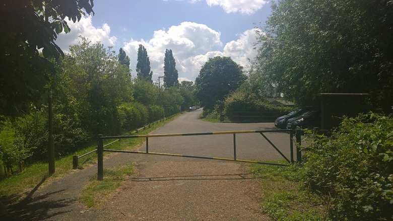
Old Charlton Road in June 2015. The modern lane recalls a route changed by the arrival of the M3.

Old Charlton Road, June 2015.

James Emmans / Geograph ↗ · CC BY-SA 2.0 ↗
Before 1086

Older traces beneath the landscape

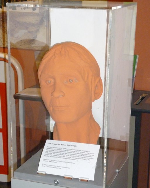
Written village history is only one part of the picture. Archaeological records for the local area include Neolithic, Bronze Age and Iron Age material from gravel pits around Charlton Village in the Shepperton Ranges area. Spelthorne’s planning evidence also identifies linear and ring-ditch cropmarks east of Charlton Road.

These finds show that people used this landscape long before the Domesday survey. They do not, by themselves, prove an unbroken village settlement on the same site. They offer a much older backdrop to the named community recorded in 1086.

The Shepperton Woman reconstruction on display at Spelthorne Museum in 2012.

The Shepperton Woman reconstruction at Spelthorne Museum, 2012.

Sean Davis / Geograph; reconstruction by Caroline Wilkinson, University of Manchester ↗ · CC BY-SA 2.0 ↗
1086

Cerdentone: our earliest written story

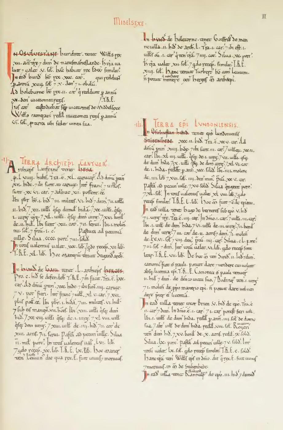
Charlton Village appears in the Domesday survey of 1086 as Cerdentone, in the historic county of Middlesex. Spelthorne Borough Council includes it among the settlements recorded in the medieval Hundred of Spelthorne. The familiar village name therefore reaches back more than nine centuries in the written record.

The wider Thames valley has a much longer human history, but a regional archaeological discovery should not automatically be treated as evidence for a settlement on this exact spot. Domesday gives us a firm starting point for the named village; it is not a claim that village life began in 1086.

Page II of the Middlesex Domesday facsimile published by the Ordnance Survey in 1861.

Middlesex Domesday survey: a page from the 1861 facsimile.

Ordnance Survey Office, 1861 / Getty Research Institute / Internet Archive ↗ · Public domain — 1861 facsimile
Before 1066–1933

The manor and its changing owners

Before the Norman Conquest, two brothers held Charlton Village’s land under Archbishop Stigand and Earl Leofwine. Domesday records Roger de Rames in 1086. Denise of Charlton granted the manor to John Vautort in 1232; in 1267, a John Vautort granted the manor to the Prior of Merton.

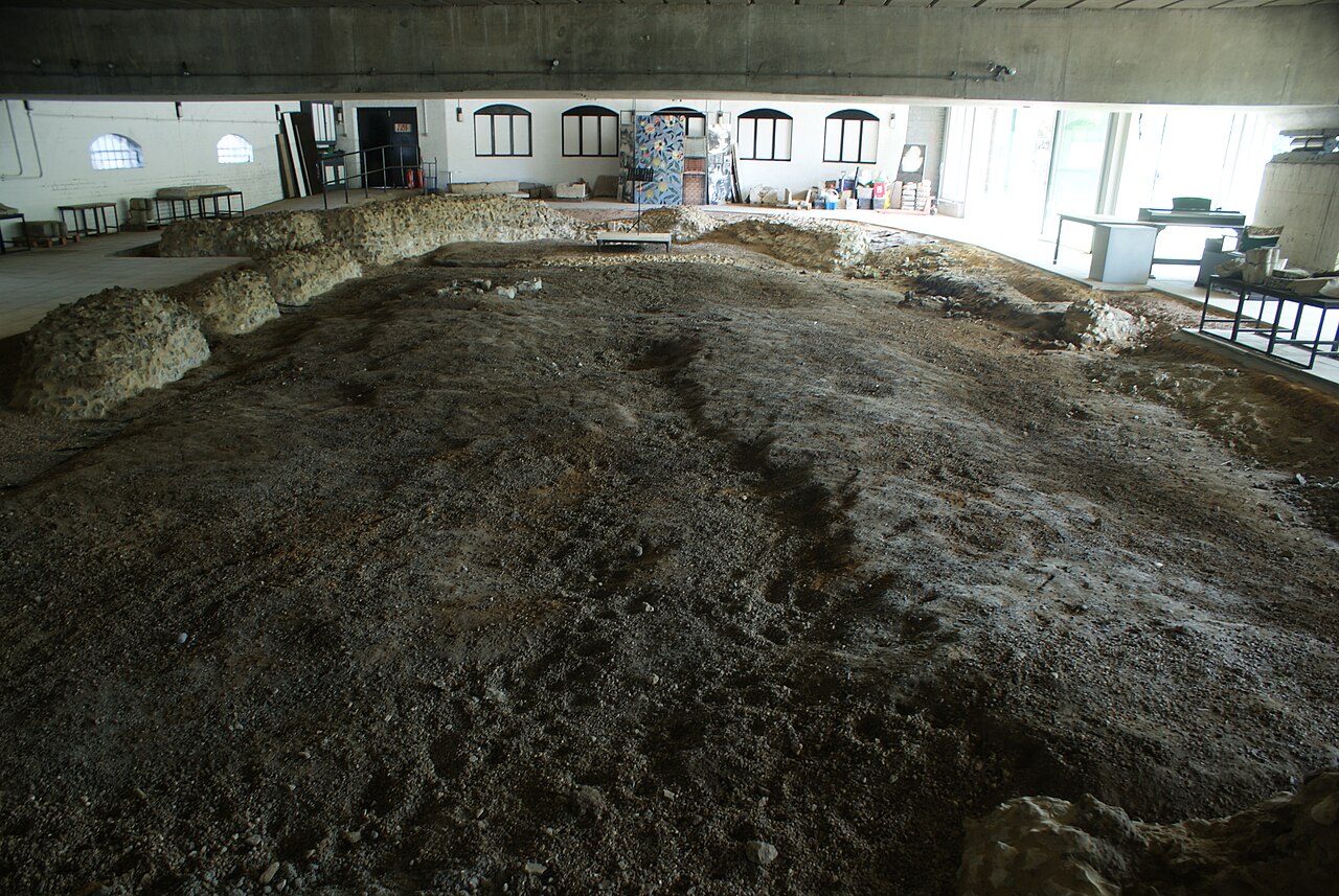
Merton Priory’s connection with Charlton Village was as the holder of its medieval manor. The priory was based in Merton, and its priors held Charlton Village’s manor from 1267 until it was surrendered to the Crown in 1538. The accompanying photograph shows the priory’s surviving remains and illustrates this part of Charlton Village’s landownership history.

The Crown granted it to Sir John Mason in 1550. It passed through Nicholas Thorp and his son George, Matthew Paleson in 1615, and George Cole in 1620. A later George Cole sold to John Grice in 1676. Thomas Grice held it in 1775; his widow, later Mrs Margaret Edwards, retained it into the nineteenth century.

Samuel Dendy held the manor in the 1830s, followed by Arthur Dendy. Arthur’s daughter married Sir John Seale, recorded as lord in 1901–1905. Edith Simpson, J. C. H. Seale and H. D. Seale were joint lords in 1906; Simpson and J. C. H. Seale remained recorded in 1933. Manorial lordship does not establish ownership of every modern house or plot.

Remains of Merton Priory viewed from the chapter house in 2018.

The remains of Merton Priory, 2018. Its priors held Charlton Village’s manor from 1267 to 1538.

Robert Lamb / Geograph ↗ · CC BY-SA 2.0 ↗
Medieval roots

Two churches, a shared local history

Charlton Village’s older parish connections were with Sunbury, and residents looked to St Mary’s there for worship. This helps explain why family historians may find village baptisms, marriages and burials among Sunbury records. The surviving parish collection at The London Archives begins in 1565. St Mary the Virgin’s present building replaced its medieval predecessor in 1752 and was extensively remodelled in 1857.

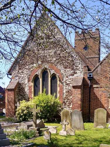
Nearby St Mary Magdalene in Littleton has its own distinct history. The church’s account dates its foundation to 1135 and links it with Benedictine monks from Chertsey Abbey. Its fabric reflects many centuries of change: medieval aisles and furnishings, a Tudor tower subsequently heightened, and later additions. The church celebrated its 850th anniversary in 1985.

St Mary Magdalene now serves Charlton Village as well as Littleton, Shepperton Green and southern Ashford Common. The two churches belong in our village story without confusing their separate histories.

St Mary Magdalene, Littleton, photographed in April 2025. A modern view of the historic church.

St Mary Magdalene Church, Littleton, April 2025.

Mertbiol ↗ · CC0 ↗
16th century–1852

The Harrow: from house to village inn

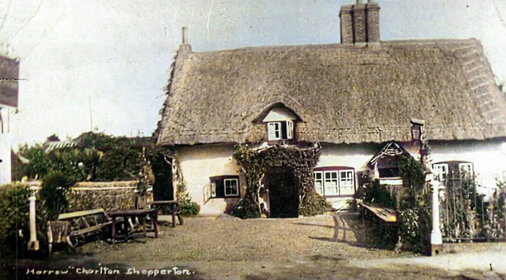
The Harrow’s whitewashed walls and thatched roof are among Charlton Village’s most recognisable features. Historic England dates the timber-framed building to the late sixteenth or early seventeenth century and records its Grade II listing.

Its life as a pub came later. Local historian Nick Pollard identifies 1852 as the year it became licensed, with William Lock as the first licensee. Lock also worked as a market gardener—a reminder of how closely village businesses and the surrounding land were connected.

Pollard’s illustrated account shows the building during Edwin Carter Unsted’s tenancy in the early twentieth century, when a separate cottage still occupied part of the same roofline. The old postcard offers a glimpse of a village before piped water and electric light became ordinary comforts.

An old view of the Harrow in Charlton Village, showing its thatched roof, white walls and front garden. Historic photograph colourised by Elad Hiles.

A historic view of The Harrow, Charlton Village.

Colourisation by Elad Hiles — used with permission ↗ · Used with permission
Fields–1950s

Before the houses: fields, common and gardens

Much of the landscape around Charlton Village was agricultural, with farmhouses and cottages rather than today’s residential roads. Charlton Village stood on the edge of Sunbury Common. Open fields lay to the south, including Charlton Field between Charlton Road and Upper Halliford Road.

Enclosure in 1803 reorganised the common and open fields into individual holdings and helped establish the later road pattern. Farming remained important, with market gardens and glasshouses also characteristic of the wider parish.

The Victoria County History describes relatively little new building in the western part of the parish before the 1950s. By its 1959 revision, many new houses were being built at Charlton Village, alongside gravel working and industrial development. The village’s transition was therefore gradual: an older farming settlement became part of a changing suburban landscape, while farms and open land survived alongside new homes.

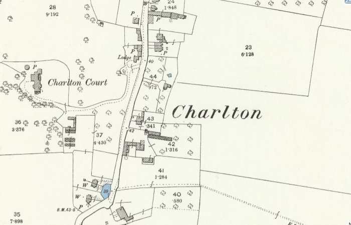
Historic Ordnance Survey map showing Charlton Court west of Charlton Road, with its grounds, curved drive and lodge.

Charlton Court and its grounds on OS mapping from the 1892–1914 collection.

Reproduced with the permission of the National Library of Scotland ↗ · CC BY 4.0 ↗
18th–20th centuries

Manor Farm: granary, piggery and stables

Manor Farm at 126 Charlton Road preserves clues to the working landscape that once surrounded the village. Spelthorne’s local heritage list describes a mid-nineteenth-century red-brick farmhouse, a group of barns or stables, and a raised granary dating from the late eighteenth or early nineteenth century. Its stone supports helped protect stored grain. These buildings were locally listed in 2004.

The remembered pig farm is supported by a local history account of the watersplash. Describing the River Ash crossing photographed in 1968, Village Matters places Manor Farm’s piggery at the Charlton Village end. Farming was part of everyday village experience, from the sounds and smells to a tractor called on when a car became stuck in the ford.

A later chapter appears in the council’s planning register: an application to change land and buildings at Manor Farm into an equestrian training centre was approved, with conditions, on 1 February 1995. That documents the move towards equestrian use; it does not establish the exact date every part of the older farm stopped operating.

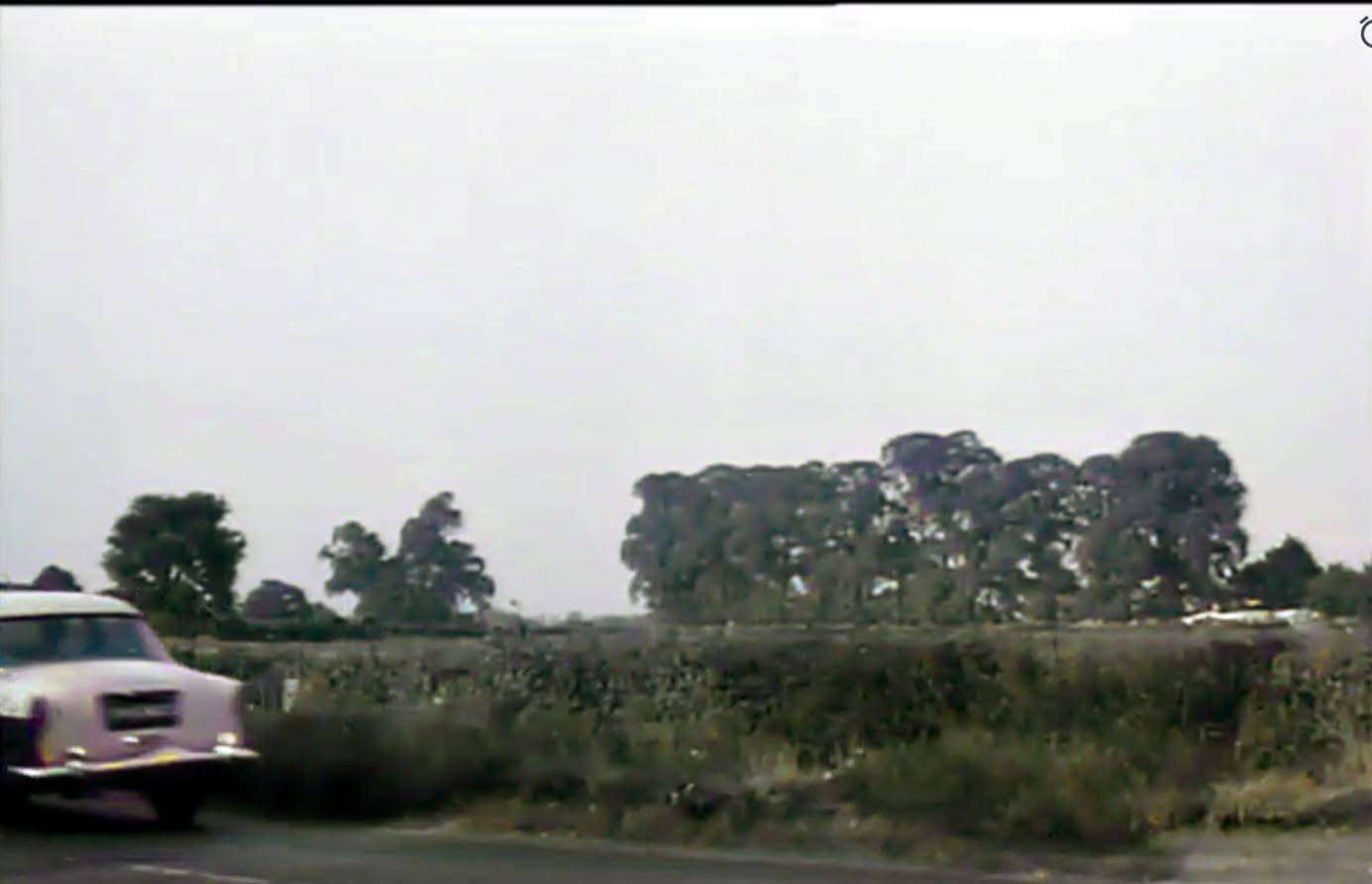
Historic view from Charlton Road towards the back of Manor Farm, captioned 1963 in The Grapevine.

Looking from Charlton Road towards Manor Farm, captioned 1963.

Elad Hiles / The Grapevine — used with permission ↗ · Used with permission
Around 1900

Harrow Farm and the dairy connection

Harrow Farm is another important name in Charlton Village’s farming landscape, distinct from Manor Farm. A history of Josiah Clarke’s dairy business, published by Twickenham Park Residents Association, identifies Harrow Farm, Shepperton, as a source of milk for the expanding Richmond and Twickenham business and names George Gait as its manager.

This account connects local farming with the daily needs of a growing London population: milk produced beyond the town travelled into a network of shops and households. The account’s suggestion about Gait’s family relationship is tentative, so we have not treated that relationship as established fact.

More recently, Harrow Farm remains identified by name on council planning maps alongside Charlton Road. Its precise founding date, sequence of farming families and changes in livestock or crops deserve further work with maps, directories and family records. If your family worked there, your memories or photographs could help fill those gaps.

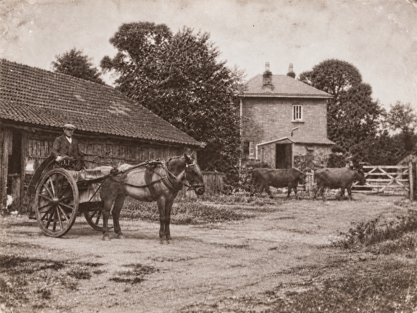
Vintage-style farmyard illustration with a horse-drawn cart, cattle, a barn and farmhouse.

Harrow Farm — vintage-style composite illustration.

Supplied by Pat Fewster
19th–20th centuries

Gravel, brickearth and the changing ground

The ground beneath and around Charlton Village also became a working resource. The Victoria County History records nineteenth- and early twentieth-century brickearth digging in Sunbury parish, followed by extensive gravel extraction around Charlton Village, Halliford and Sunbury Common. Work was still continuing at Charlton Lane in 1959. Mixed farming survived around Charlton Village at the same time.

Extraction left pits and pools and changed how some parcels of land could be used. A 2022 Spelthorne site assessment describes land north of Charlton Lane, between the M3 and the railway, as former gravel workings subsequently backfilled with inert material and used for grazing. This is evidence for that particular site, rather than a claim that every village street stands on a filled pit.

The pits also exposed older traces of human activity. Local archaeological finds remind us that gravel working sometimes revealed evidence of the landscape’s much earlier inhabitants.

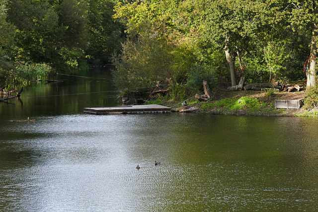
A former gravel pit beside the Upper Halliford to Charlton Village path, used as a fishing lake in 2015.

A former gravel pit beside the Upper Halliford–Charlton Village path, 2015.

Alan Hunt / Geograph ↗ · CC BY-SA 2.0 ↗
Old estate–1960

Charlton Court and today’s Walnut Tree Road

The old house associated with the Walnut Tree Road area appears on historic Ordnance Survey mapping as Charlton Court. It stood west of Charlton Road, in its own grounds, with a curved drive and a lodge beside the road. The map preserves a view of this estate before the later residential streets.

Lewis George Leverson appears at Charlton Court in a surviving Kelly’s directory. Sidney J. Pocock, later Sir Sidney, is also documented as a resident: a report dated 19 June 1908 gives his address as Charlton Court, Middlesex. These are records of residence; a complete sequence of legal owners and the house’s construction date still needs confirmation.

Council application SUN/FUL/3850J authorised 34 houses and garages on the Charlton Court Estate on 28 December 1960. Its associated properties include Almond Close and Walnut Tree Road, confirming the connection with today’s neighbourhood. The permission does not establish the exact demolition date.

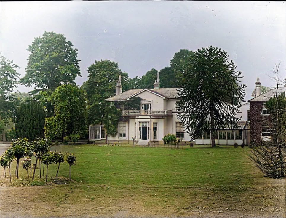
The colourised photograph shared by Elad Hiles in The Grapevine is labelled 1916. We reproduce it with permission and credit; its colours are a later interpretation. The historic map elsewhere on this page shows the house and grounds before the modern estate. Family photographs and memories could help fill the remaining gaps in its story.

Charlton Court viewed across its lawn, with mature trees and the house’s central entrance. Historic photograph colourised by Elad Hiles.

Charlton Court, labelled 1916 in The Grapevine’s archive.

Colourisation by Elad Hiles — used with permission ↗ · Used with permission
1915–1925

Queen Mary Reservoir: a landscape transformed

The reservoir changed this corner of Middlesex on an enormous scale. Work on the project, originally known as Littleton Reservoir, began in 1915. Wartime demands interrupted construction; work resumed after the First World War. Geological difficulties forced changes to the design and the enlarged footprint displaced much of old Littleton.

Steam excavators, temporary railway tracks and painstaking clay work created a vast raised basin. Water brought from the Thames at Laleham was pumped into storage for London’s supply. King George V and Queen Mary opened the completed reservoir on 13 June 1925, giving it the name we know today.

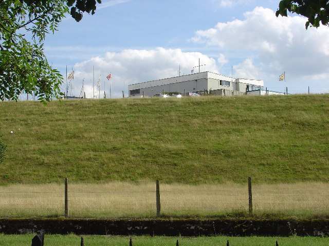
For Charlton Village it became a defining neighbour: the high grassy embankment marks the edge of the village landscape. Today water supply sits alongside sailing, wildlife and the continuing story of the communities around it.

Queen Mary Reservoir’s embankment and sailing-club buildings, viewed from the north in August 2005. This is a modern photograph.

Queen Mary Reservoir’s northern embankment, August 2005.

steve / Geograph ↗ · CC BY-SA 2.0 ↗
1913–1998

Lost Astleham and the cottage that moved twice

Queen Mary Reservoir changed more than the skyline. Beneath its footprint was an older inhabited landscape. Historic England's record for Astleham Manor Cottage describes Astlam—another spelling of Astleham—as a village covered when the reservoir was built. This was land taken into a planned water-supply scheme, with buildings cleared or moved before the reservoir filled.

The effects reached neighbouring Littleton too. Local historian Nick Pollard describes how changes to the reservoir design removed a substantial part of old Littleton and much of its green. A road from Squire's Bridge towards Ashford Common was diverted to become New Road, where replacement houses accommodated displaced villagers. That is different from saying every house was moved intact: new housing and the rescue of an individual old building were separate responses to the upheaval.

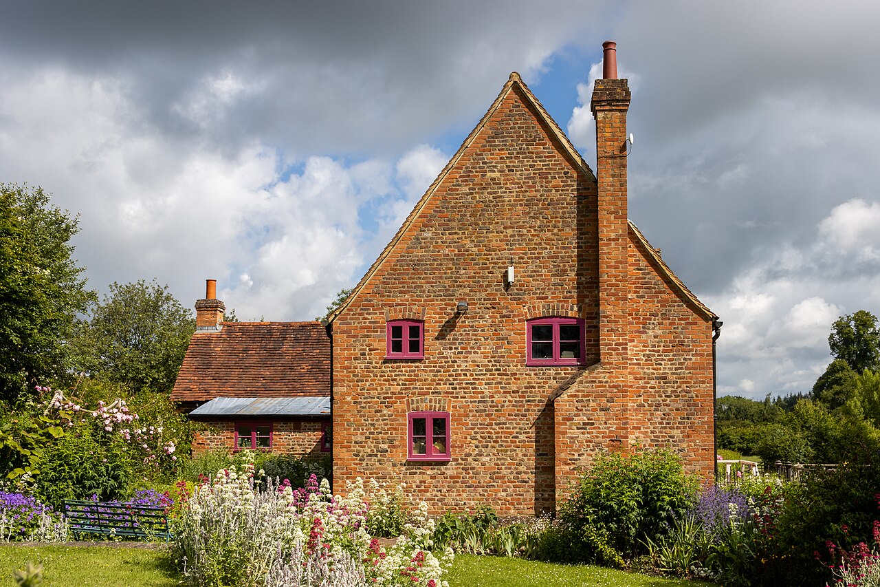
Astleham Manor Cottage offers a remarkable surviving connection. Chiltern Open Air Museum traces its origins to a sixteenth-century timber-framed hall house, later enlarged and altered. In 1913, owner Sir Richard Burbridge had it dismantled and rebuilt roughly a quarter of a mile south to make way for the reservoir. Historic England also records the reuse of original materials.

The museum identifies Mr Ferris, Burbridge's gamekeeper, as an early resident after the move; his family remained associated with the cottage for decades. In the 1990s, after vacancy and vandalism, nearby gravel extraction threatened it again. It was rescued for a second time and re-erected at Chiltern Open Air Museum, where the museum's office moved in during 1998. The building is used for staff and volunteer facilities rather than as an ordinary open-to-visit cottage.

A little local folklore: the bell beneath the water

According to a local tale, a bell from the lost village church can still be heard when strong winds sweep across Queen Mary Reservoir—or even glimpsed when the water is low. It is a wonderfully eerie image: perhaps the reservoir has its very own ghost story!

For clarity, this is folklore. There is no reliable historical evidence for a church bell surviving beneath Queen Mary Reservoir, or for one becoming visible or audible in these conditions. Local historian Nick Pollard’s account of the reservoir’s construction describes the site being cleared before work proceeded. We include the tale for its local colour and amusement; it should not be read as a factual account of what lies beneath the water.

For Charlton Village and its neighbours, this story gives the reservoir a human scale: homes, familiar routes and working lives changed to supply water to a growing London. A surviving cottage lets part of that lost landscape remain tangible today.

Astleham Manor Cottage after relocation to Chiltern Open Air Museum, photographed by Mike Peel in June 2024.

Astleham Manor Cottage at Chiltern Open Air Museum, June 2024.

Photograph by Mike Peel (www.mikepeel.net) ↗ · CC BY-SA 4.0 ↗
1930s–today

Shepperton Studios: a nearby world of make-believe

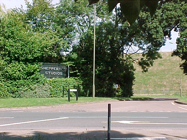
The nearby Littleton Park estate became the setting for Sound City in the early 1930s, the beginnings of what we now know as Shepperton Studios. Film production grew around an existing country house and its grounds, adding a new working life to a landscape previously shaped by estates and farming.

Pinewood’s studio history celebrates Shepperton’s tradition of independent filmmaking and films including Oliver! and Alien. A major expansion completed in late 2023 and early 2024 added 17 sound stages, with new facilities leased to Amazon MGM and Netflix.

For Charlton Village, this is the history of a close neighbour as well as a famous name on screen. Memories of local people who worked in sets, costumes, transport, catering or other studio trades could add a valuable community chapter to the better-known film history.

Entrance to Shepperton Studios in Littleton, photographed in August 2005.

The entrance to Shepperton Studios, Littleton, August 2005.

Sheel / Geograph ↗ · CC BY-SA 2.0 ↗
1940

Air-raid damage to the reservoir bank

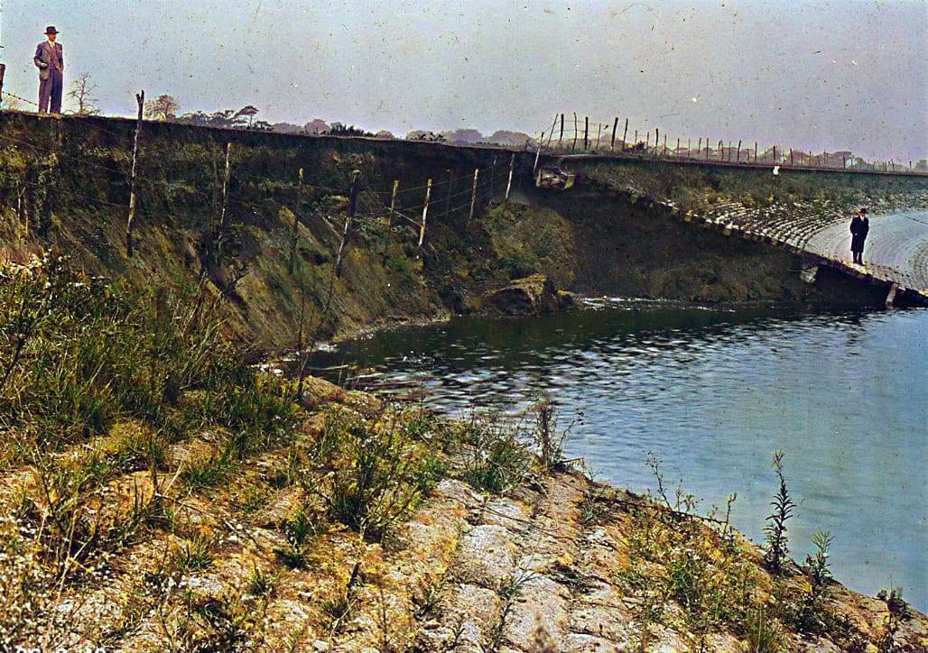
The reservoir’s wartime danger is visible in the photographic record. Thames Water’s archive holds two glass negatives dated 1940, both catalogued as air-raid damage showing a bomb crater in the south bank of Littleton Reservoir—the earlier name for Queen Mary Reservoir. Their reference numbers are ACC/2558/MW/GP/02/140/006 and ACC/2558/MW/GP/02/140/005, with the originals listed at London Metropolitan Archives, now The London Archives.

The photographs preserve a direct record of damage to the raised bank during wartime bombing. They bring this chapter of local life into view, while leaving questions for further research: the public catalogue does not give the exact day, number of bombs or full repair history.

The colourised view shared by Elad Hiles in The Grapevine brings this damage into focus. We use his supplied version with the permission confirmed by CVRA and retain his credit. Its colours are a later interpretation. The links below also let you examine the two original archive records.

A colourised historic view of damage to Queen Mary Reservoir’s bank, shared by Elad Hiles as a 1940 wartime photograph.

Wartime damage to Queen Mary Reservoir’s bank, captioned 1940.

Colourisation by Elad Hiles / The Grapevine — used with permission ↗ · Used with permission
27 April 1943

Remembering two Polish Spitfire pilots

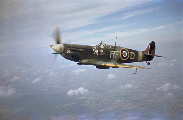
On 27 April 1943, two pilots of No. 316 (Polish) Squadron lost their lives in a training collision. They were Sergeant Jerzy Janusz Gierczycki and Sergeant Antoni Stefan Plenkiewicz. The loss records identify their aircraft as Spitfire Vb AR382 (SZ-W) and Spitfire Vb EP108 (SZ-B), and place the crash at Manor Farm, Shepperton.

Aircrew Remembered describes a camera-training exercise from RAF Northolt. The accounts concern two separate single-seat fighters colliding in training, rather than one shared aircraft being shot down in combat. The published sources do not establish a precise present-day impact point in Charlton Village.

Their names give a human meaning to this local wartime story. Remembering them also recognises the dangers faced during training by Polish airmen serving alongside the RAF. The linked records contain further biographical information and portraits of the men.

A period Spitfire Mk Vb of No. 303 (Polish) Squadron, RF-D. It illustrates the aircraft type and does not show either No. 316 Squadron aircraft involved at Manor Farm.

Spitfire Mk Vb RF-D of No. 303 (Polish) Squadron during the Second World War.

British government photograph; photographer unknown ↗ · Public domain
1943: secret trials

Sleeping Beauty on the reservoir

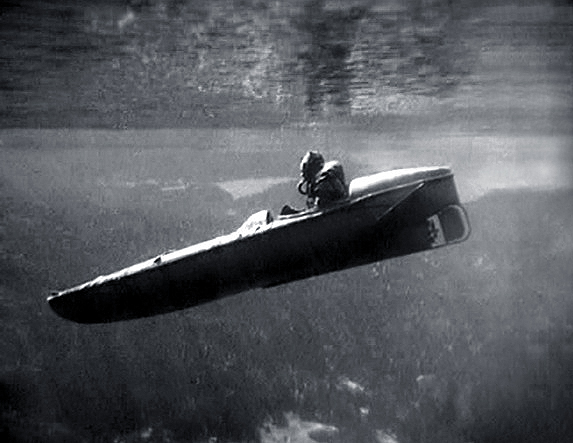
The reservoir had a less obvious wartime role as a place to test secret equipment. Thames Water records trials in 1943 of small submersible craft nicknamed Sleeping Beauty. A familiar local expanse of water was part of a much wider story of wartime invention.

That connection was remembered in 2010 when Prince Philip visited and a modern replica was unveiled. The reservoir’s engineering heritage therefore reaches beyond water supply to the experiments carried out here during the Second World War.

A Sleeping Beauty motorised submersible canoe during a US Navy demonstration in 1944.

A Sleeping Beauty craft at a US Navy demonstration in the USA, 1944.

United States Navy / Wikimedia Commons, restored version ↗ · Public domain — US Navy work
1968–1974

The watersplash and a new road through the landscape

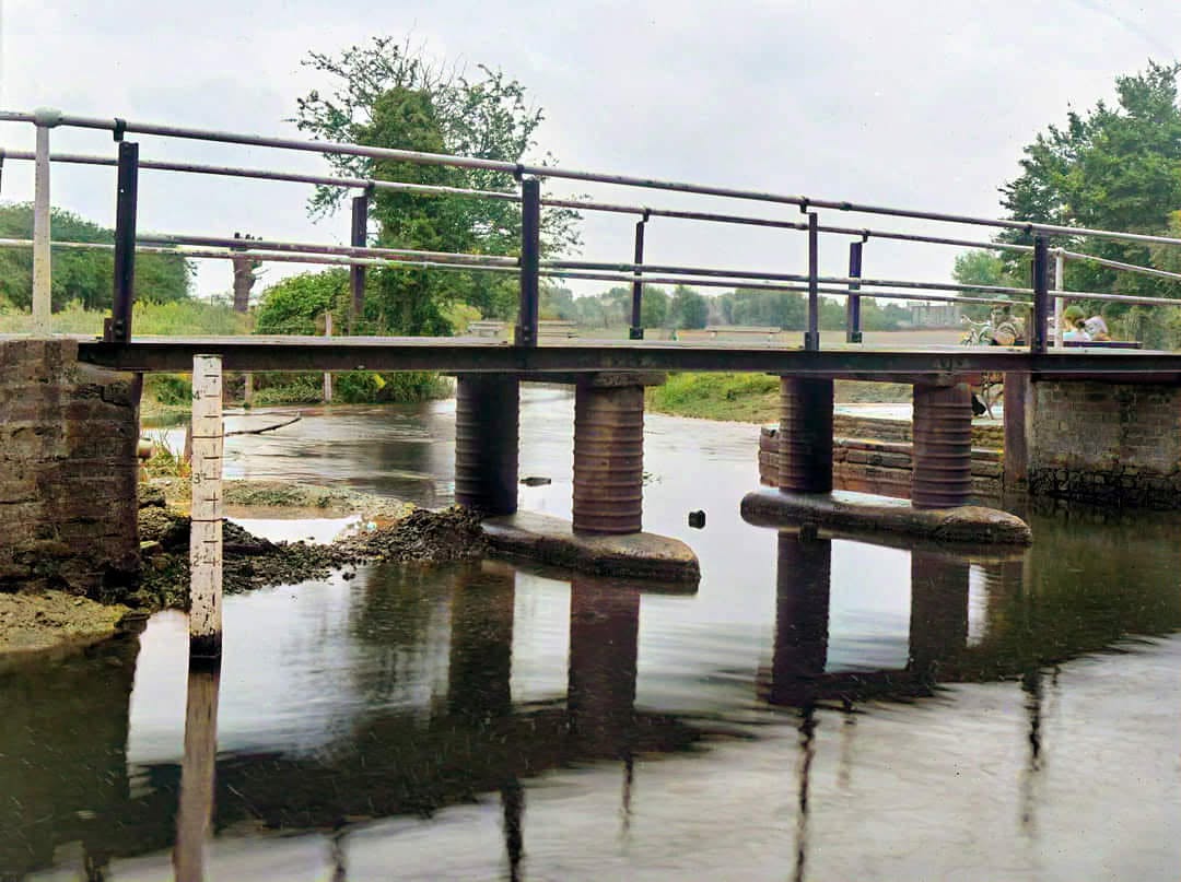
A 1968 photograph preserves Charlton Village’s watersplash: the ford where Charlton Road crossed the River Ash beside a footbridge. It is a reminder that a familiar journey once meant meeting the river at water level.

The M3, opened here in 1974, changed that route. The old road was divided, with the Shepperton end becoming Old Charlton Road and the village end becoming Nutty Lane. The watersplash scene now lies within the motorway corridor.

Nearby footpaths still connect the area, while Splash Meadow and Nutty Wood form Ash Link Nature Reserve. The old and new names help us read the landscape: a river crossing, a motorway and pockets of green space each mark a different chapter.

Historic view of the Charlton Road watersplash, captioned 1958 in The Grapevine.

The Charlton Road watersplash, captioned 1958.

Elad Hiles / The Grapevine — used with permission ↗ · Used with permission
Today

A living village, still writing its story

Charlton Village’s history belongs to the people who live here as much as to old buildings and archive records. Farm names, the Harrow, the reservoir bank and the routes we walk all carry traces of earlier village life. Houses and roads have changed the setting, but the wish to know our neighbours and care for our surroundings continues.

CVRA brings that work into the present: representing members, listening to ideas, supporting village activities and helping protect the character and future of Charlton Village. This page is a growing community record, with room for family photographs, memories of working life and stories still waiting to be told.

Continue exploring with Spelthorne Museum’s collections and online features, and the local history articles in Village Matters. The museum’s publications include Lost Houses of Sunbury and Shepperton and studies of local pubs, useful starting points for further village research.

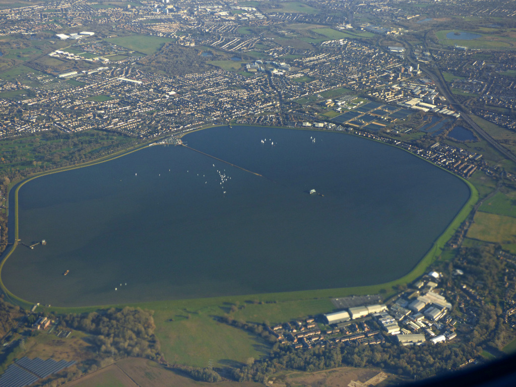
Aerial view of Queen Mary Reservoir and the surrounding landscape, photographed on 19 January 2020.

Queen Mary Reservoir and the surrounding landscape from the air, 19 January 2020.

Thomas Nugent / Geograph ↗ · CC BY-SA 2.0 ↗

Share your Memories

Do you have old photographs, family stories or memories of Charlton Village? Perhaps you remember the farms, Charlton Court, the watersplash or working at Shepperton Studios. Get in touch and help us preserve our village’s story for future generations. We’ll agree permission and a credit before sharing any photographs.

Share a memory